To McKenzie Bridge, Oregon -- 75.3 miles, 12.7 mph, 3550 ft
We climbed the last pass today on our relentless journey west. Our work today and the last few weeks was rewarded with a fabulous 17 mile, no-pedal descent, winding through pine forest. But first, our day, as usual started at 6:00. After the long day yesterday, Meg and I took a couple deep breaths knowing today would be even longer. Nevertheless, it was a beautiful, warm, morning portending yet another hot one. Craig and Sharyl, being the awesome people they are, were up early and had water boiling for us.
 |
| View from our "window" |
 |
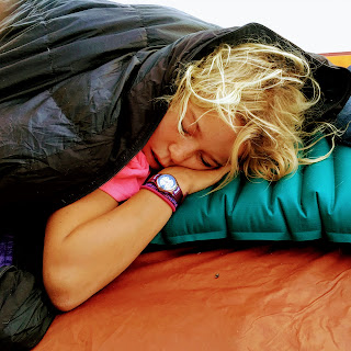
| Sleepy Head One |
 |
| Sleepy Head Two |
 |
| Smith Rocks |
We knew there would be one town on the route today, thirty one miles away, so, of course, the plan was for a second breakfast there, in Sisters. This section of the route has got to be my favorite of the entire ride! We rode through beautiful farm and ranch land with meadows, pine forest, and the amazing snow capped volcanos, the South, Middle, and North Sisters. It really was absolutely spectacular.
After a good morning workout, we rolled into the town of Sisters, which was completely packed. Apparently, the world's largest quilting festival was in full swing. Every building in town had fantastically elaborate quilts hanging from it. Fortunately, we snaked our way through the crowded streets for breakfast just at the edge of town at Takoda's.
After a good morning workout, we rolled into the town of Sisters, which was completely packed. Apparently, the world's largest quilting festival was in full swing. Every building in town had fantastically elaborate quilts hanging from it. Fortunately, we snaked our way through the crowded streets for breakfast just at the edge of town at Takoda's.
I've always prided myself on not sweating much, but the climbs the last two days, first up Ochoco and today up McKenzie Pass were a total sweat fest. My shirt was drenched, my shorts and waist pack had salt stains, sweat was dripping on my phone and stinging my eyes, so I finally had to stop for a few minutes. Like most things, perseverance counts for a lot; an hour or two of climbing, and we were at the top.
 |
| Unfortunate motorist pulled a little too far over |
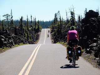
As I crested Windy Point, an apropos blast of wind struck me, which I was immediately grateful for. It was here that we got our first view of the vast lava fields that cover this area.
When Kevin arrived with Sue and April, he suggested that Meg might not be doing well, so I headed down with April’s unloaded bike. Though she and Dex weren't far down the hill, she was hot and not particularly happy. I swapped bikes with her so she could get up the rest of the hill more easily and get something to drink.
At the true summit, a few more miles up the highway, we climbed to the stone observatory to eat snacks and admire the scenery before the final push to McKenzIe Bridge. Because of the heavy snowfall this winter, the numerous volcanic peaks -- the Sisters, Mt. Washington, Mt. Jefferson etc. -- were still blanketed in snow.
At 4:00 p.m., we finally headed out, still with almost thirty miles to go. The good news was that this was probably the longest descent of the entire trip. Starting at over 5000 ft, once we started down in earnest, we would drop to less than 2000 ft with hardly a pedal stroke. I had no idea Kevin was such a speed demon going down. Typically, the tandems propel themselves down so fast that Meg and I end up far out in front. This time, though, the tight switchbacks with 15 and 20 mph warning signs, kept our speed in check, and it wasn't until the final five miles or so that we could ignore the brakes completely.
 |
| Rolling along at the top of McKenzie Pass |
 |
| Regrouping at the bottom |
Lucky for us, a friend of Kirk has a house in McKenzie Bridge just off the bike route and agreed to let us use the house and camp outside in his dirt drive way while he was away. Stopping a few miles short for some refreshments and snacks plus a quick fix of a flat on my bike, at 7:00 we arrived at the house. Another long day, but we were now guaranteed to reach our next major waypoint... April's house in Eugene, Oregon... tomorrow.


No comments:
Post a Comment